
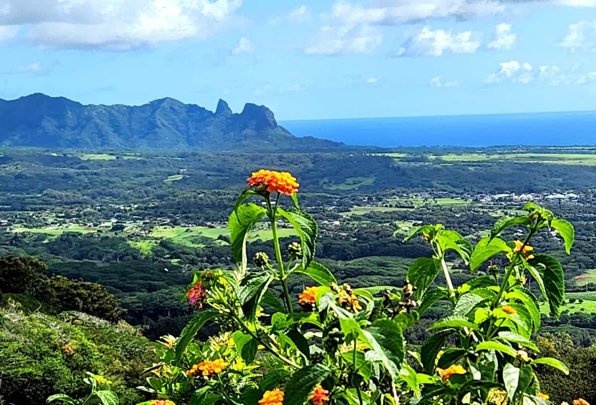
The Sleeping Giant Nounou Mountain East Trail transports hikers through a rather traditional forest before heading upwards for dramatic views of Kapaa, Mt. Waialeale, the Wailua River, the Makahela Mountains, and other parts of eastern Kauai.
Located near Kapaa and the Wailua Homesteads, the Nounnou Mountain trails are a favorite for local families as well as far-flung travelers. The popularity of the Sleeping Giant Trail is in some part due to the central location near Kauai’s population centers.
Trail runners and individuals seeking a quick getaway to nature are often found on the trails. Legend has it this giant ate so much that he laid down for a nap and never awoke.
- Length: 3.4 miles out and back
- Area: Wailua/Kapaa
- Difficulty: Moderate to Difficult
The Nounou Mountain East Trail gets its name because of the profile of the mountain which resembles a sleeping giant. The giant’s head is to the left in the above photo. There are several Hawaiian legends concerning the sleeping giant, including one where the giant overate at a feast in his honor, then laid down to rest and has yet to awaken.
One can see the Sleeping Giant Trail from the highway, a helicopter tour, or a beautiful view from the Smiths Luau grounds. This hiking trail may look intimidating, but it’s a great running workout or a moderate hike for most, including families and for your dogs.
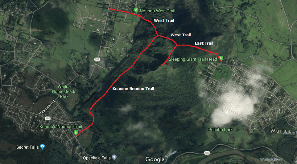
There are actually 3 different trails that make up The Sleeping Giant Trail. There is the East Trail, The West Trail, and the Kuamoo-Nounou Trail. We will cover the beautiful Nounou Mountain East Trail, which is a gradual uphill trail 3.4 miles out and back and an ocean view.
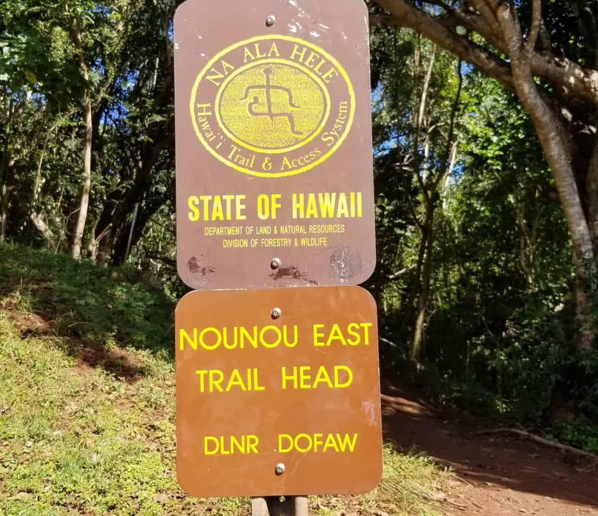
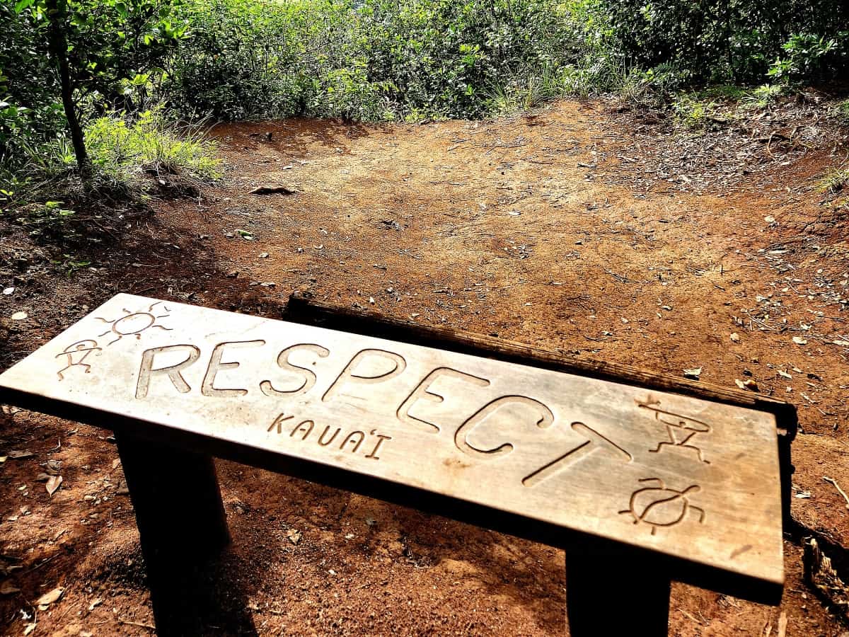
You can find the Nounou Mountain East trailhead in a small parking lot on Haleilo Rd in Kapaa. There is a sign for the trailhead so it’s easy to spot. Don’t worry if the parking lot is filled up, since you are also allowed to park along both sides of the street. It’s located in a quiet neighborhood, so please be respectful to the homeowners. Whether you travel from the north or south on Hwy 51, the Kuhio Hwy, go west on Haleilio Rd for just 1.1 miles, and you can see the parking lot on your right.
I would rate this trail’s difficulty as moderate for the average hiker/runner. To others it might be more difficult depending on the time of year you visit and due to the two areas of scrambling up the rocks.
The time of year you hike it will increase or decrease the difficulty due to the higher chance of rain in the area. Since there is so much of the trail under cover, the trail here doesn’t always dry out. This causes certain sections of the trail to become slippery or very muddy at times.
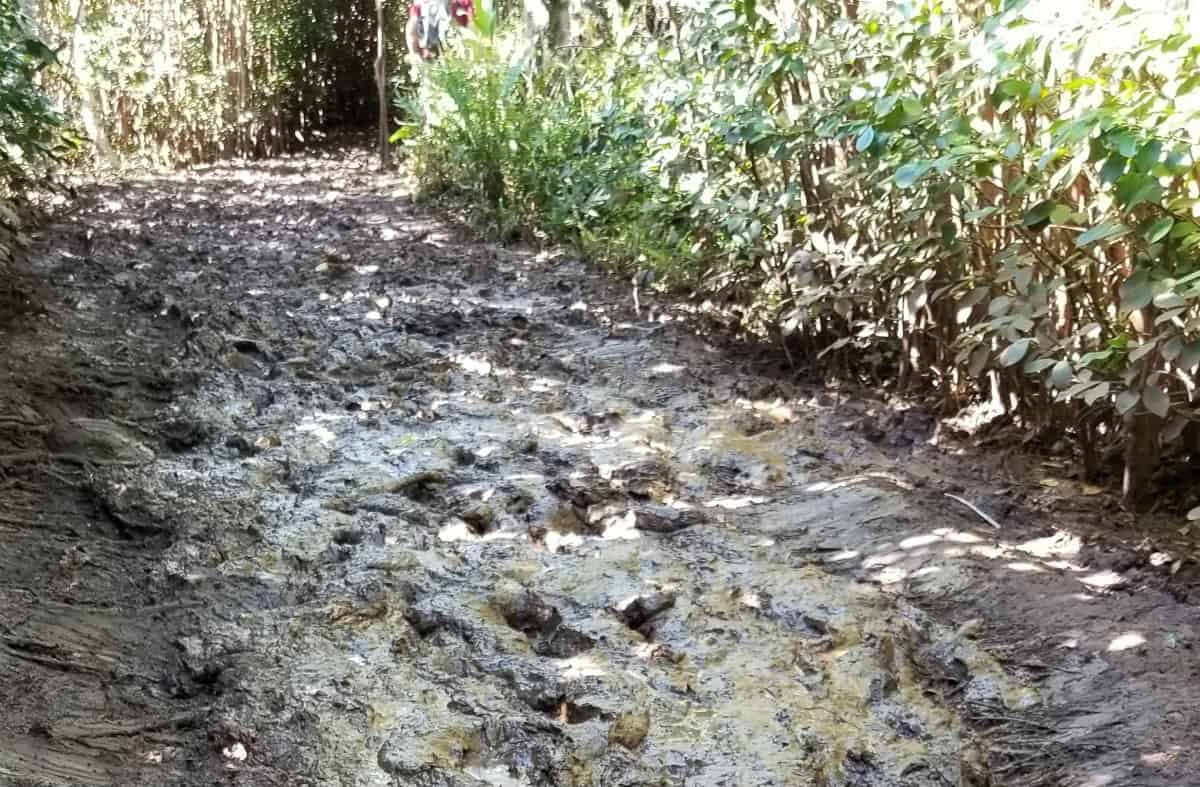
Hence, at mile 1.75 I’ve dealt with 4 inches of thick slimy mud for about 10 yards. This section is still doable by walking along the side and grabbing branches. I advise you to avoid wearing any nice shoes you don’t mind throwing away and definitely bring a change of shoes with a plastic bag in your car after you finish hiking.
The trail is a gradual uphill hike with a couple of spots that are flat to stop and rest. You will see there is a beautiful bench in one of these areas to enjoy the view of the ocean or the valley below. As you continue on the terrain there will be some small rocks and tree roots.
Please make sure they aren’t slippery before stepping on them. This is where hiking sticks or trekking poles come in handy to maneuver around the trail.
Hiking poles also make it easier to hike the uphill section of the trail. It’s also not uncommon for people to leave strong walking sticks at the beginning of the trail. Feel free to use them and leave them for others to use too.
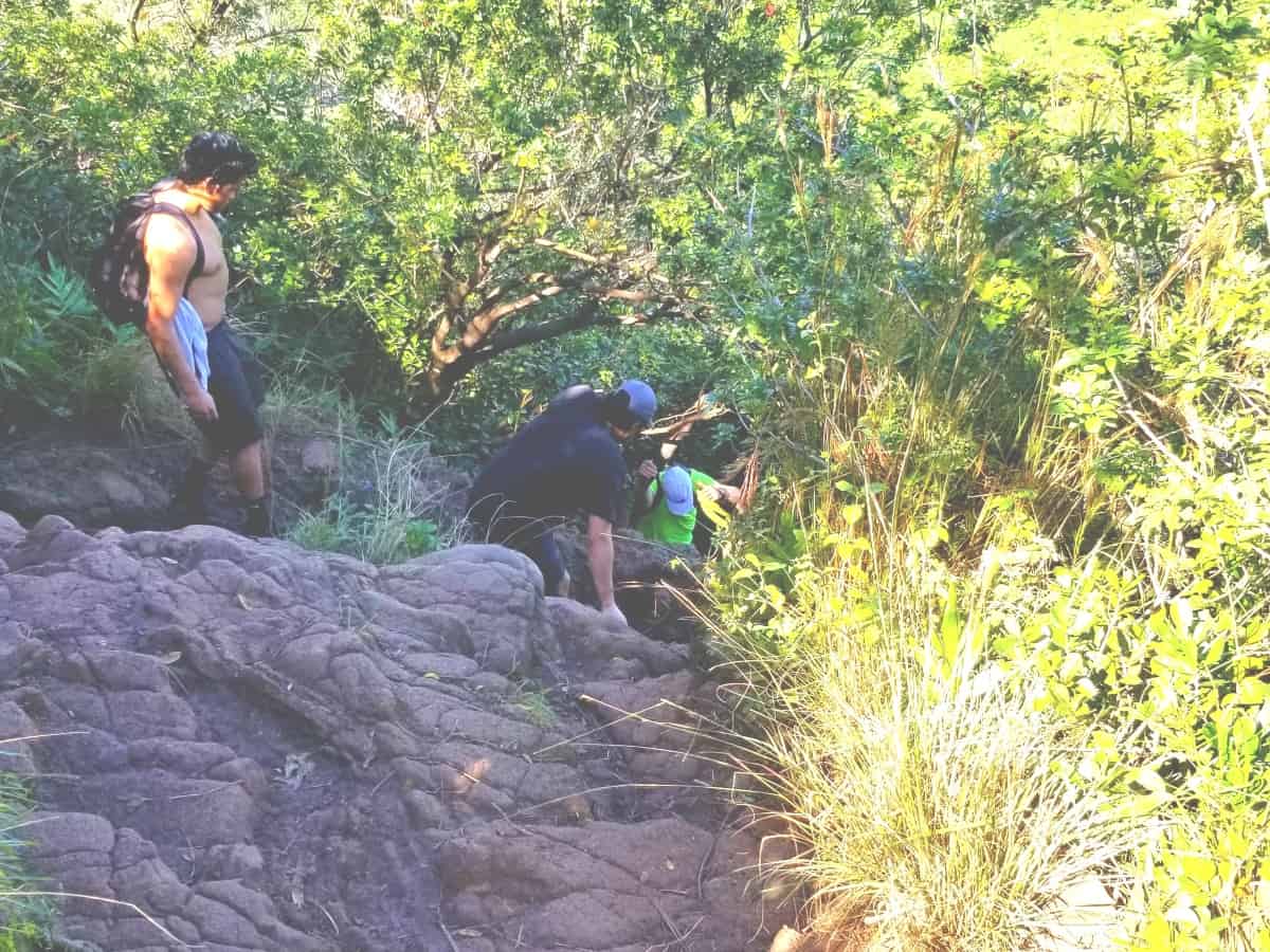
I don’t personally use them since they get in the way during the rock scrambling portion, but other hikers might find them helpful. The first rock face is about 7 to 8 ft tall but has places to grab and place your foot on to get you to the top.
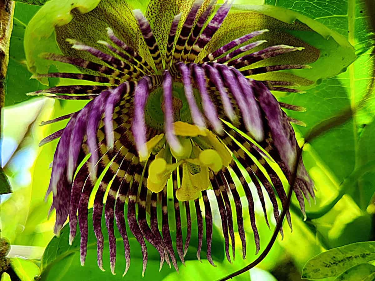
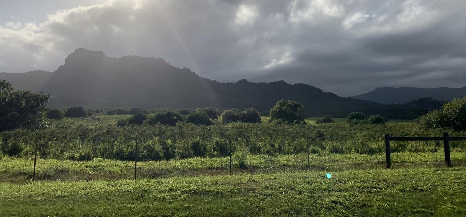
The rest of the trail is winding, and some parts are out in the open with full views of Kauai’s east ocean shore. Beautiful passion fruit flowers, guava, and other flowers bloom here. You can also see the Wailua River, Waipouli, Kapaa, and Hanamaulu Bay below.
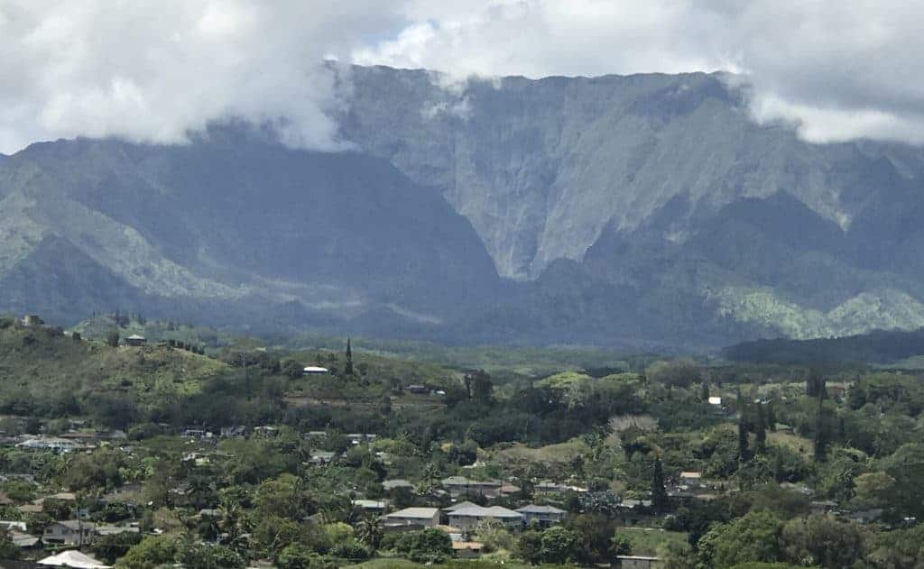
As you continue the trail switchbacks many times from the east side, where you can view the Makaleha mountain range. You can see Kauai’s famous King Kong profile, which is part of the Anahola mountain range.
At the giant’s chest are two sheltered picnic tables. There is another bench facing east to relax at or enjoy your lunch here. If this is as far as you want to go, enjoy the view of Kapu mountain and Mt Waialeale, one of the wettest spots on the earth with an average of 450 inches of rain a year. If the sky is clear, you may get a glimpse of the crater itself, but it’s generally enshrouded by clouds.
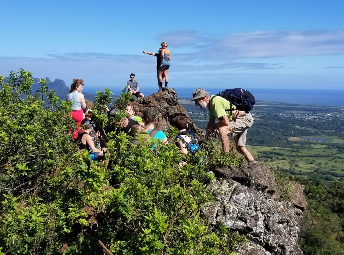
If you want to reach the giant’s face, you’ll see a narrow path from the picnic tables. It’s short but can be difficult. This is where you will need to scramble up a 14-foot wall of boulders. I go to the right, where it’s easy to find footing and tree branches to pull myself up. When you come down, go to your left the same way.
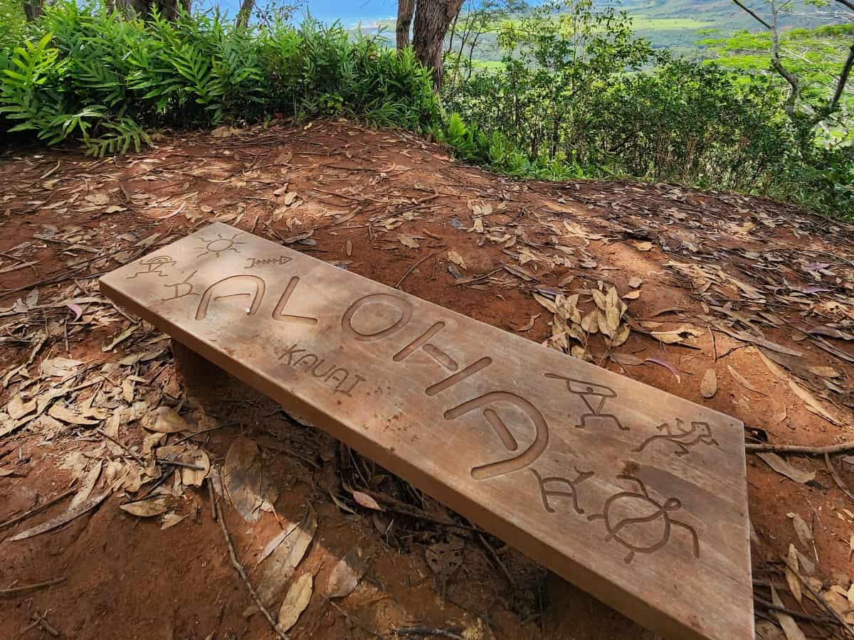
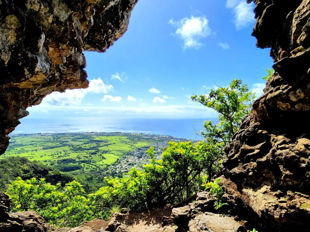
Once at the top immediately to your left is the very top and here you get the 360-degree view of the east, north, and west. Doing this on a clear day will take your breath away. When you reach the top, continue to your left and enter the hole.
It’s a wonderful place to take a selfie or group photo with the ocean view in front. We also hiked an easy 100 yards to a platform that also gave us another complete 360 views from the rock cluster.
Heading back to the parking lot is easier since it’s all downhill. Again, hiking poles are good for stability if needed, and they take the pressure off bad knees or are used to poke an area to see if it is slippery before stepping. People use hiking poles for the Kuilau Ridge Trail too which is nearby, so they’re a worthy investment.
The whole hike can be done in 2 to up to 4 hours, depending on stops, breaks, and lunch. The trail starts to get busy late morning and afternoon, so I personally recommend going early morning and yes, pass many people hiking up. After completing the hike, head to the ABC store near Coconut Marketplace for lunch to take to Lydgate Beach. It’s an excellent place to cool off, relax, and eat a well-deserved lunch.
The Nounou East trail gives a beautiful sunset view, but just be quiet since you don’t want to wake up the sleeping giant.

Written by: Debra Bowyer
Leave a comment