
The Canyon Trail to Waipo’o Falls hike in Kokee State Park is a moderate 3 or 4-mile round-trip hike depending on where you start. It has an elevation gain of 1000 to 1200 feet, yet it’s basically a gradual descent/ascent of 600 ft per mile.
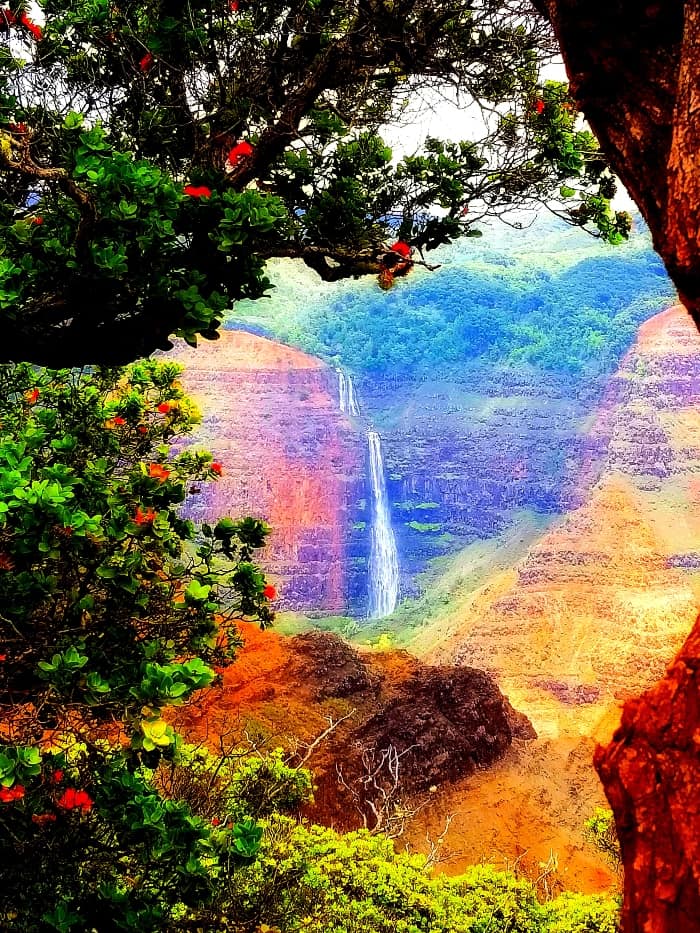
It takes an average of 2 to 4 hours depending on your speed and how long you want to explore the beautiful canyon view that ends where the Waipo’o Falls cascade down the canyon wall. Waipo’o Falls is a huge 800-foot waterfall. There are two other small waterfalls, with one that creates a pool with boulders to sit on.
Waipo’o Falls Trail Details:
- Length: 3 to 4 miles depending on the starting point
- Estimated time: 2-4 hours depending on your speed
- Difficulty: Moderate
- Pet-friendly: No dogs are allowed on this trail
From Highway 50, head up Waimea Canyon for 14 miles on the 550 for about 30 minutes. The dirt road to the trailhead is about 200 yards once you see the 14-mile marker sign. The dirt road is for 4-wheel drive vehicles only.
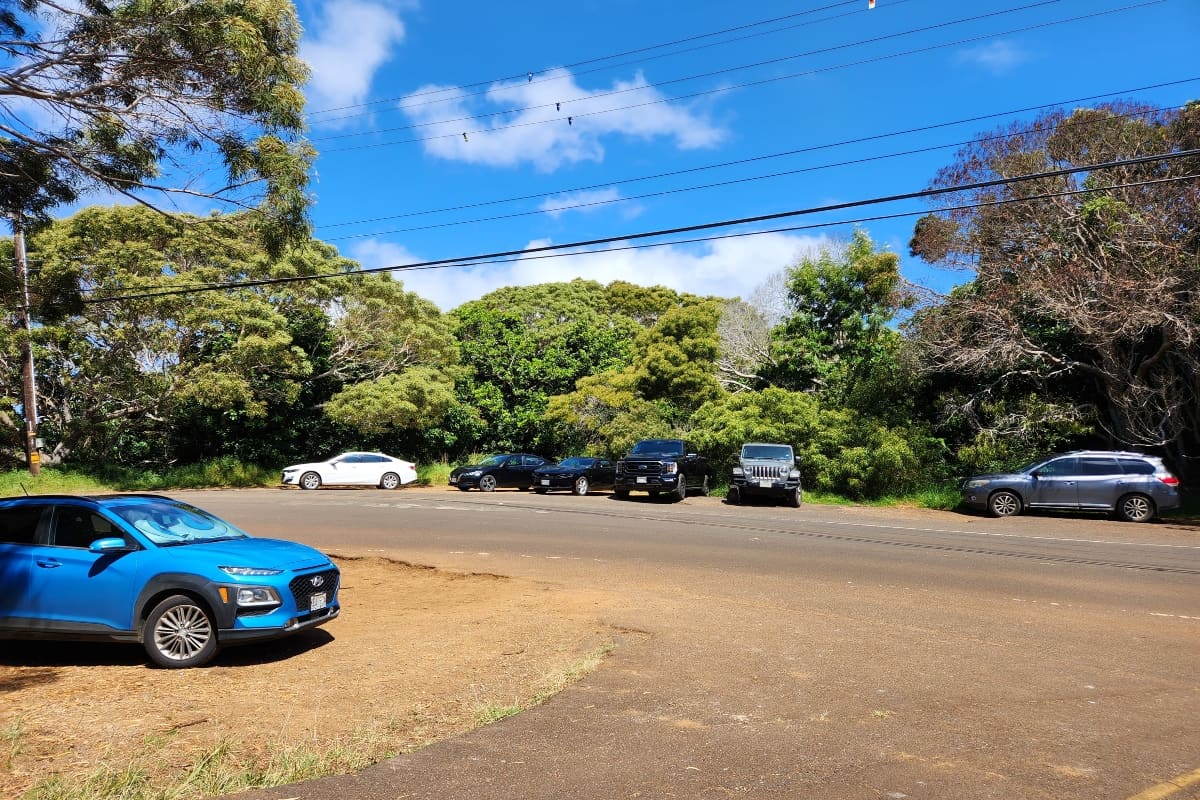
You can see cars parked at the beginning of this dirt road on both sides of the street. Walking down this road is about half a mile, so at this point the 3-mile round trip hike will be about 4 miles round trip. If you want something easier, park in the parking lot for the Pu’u Hinahina Lookout, where the trailhead starts right in the back of it.
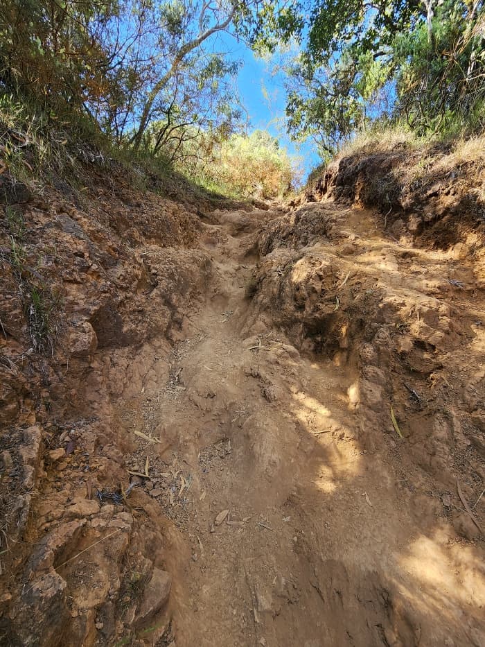
This dirt road is muddy and can become slippery for even a 4-wheel drive vehicle and makes for a very bumpy ride. It also becomes very narrow as you get within a couple of hundred yards of the parking lot. You will most likely have to back your car up if another car is in this narrow section. Walking is very manageable wet or dry.
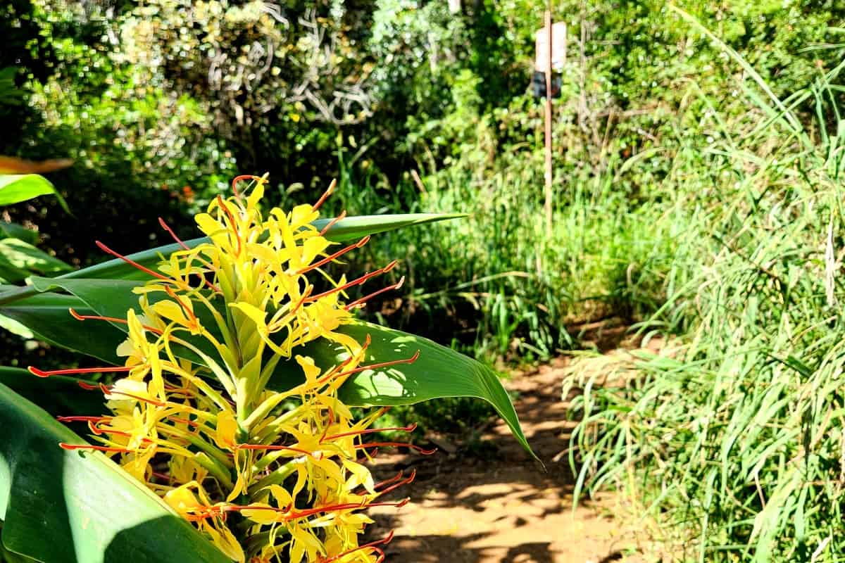
I actually enjoy walking the road since you can see and smell beautiful foliage. The flowers along the road are the very red Fuchsia Boliviana that hang like teardrops. You can also see orange Montbretia and yellow Nasturtium and smell the fragrance of the Kahili Yellow Ginger, especially when fields of these are in full bloom.
If you smell Christmas trees, that’s cause there’s a section of beautiful pine trees growing along the road too. Hiking sticks are recommended for those who prefer or need extra support. When dry, the trail will have loose red dirt or be muddy if it has been raining. It can be very slippery either way. I definitely recommend good traction hiking boots due to the mud.
There are no restrooms. However, as you drive up Kokee you pass both the Waimea Canyon Lookout and the Pu’u Hinahina Lookout on your right. There are bathrooms and beautiful views of the canyon and Niihau. There is also a picnic area with restrooms on the opposite side of the street, the Pu’u ka Pele.
Cross the street from the picnic area to view the Waipo’o Falls and see the rim where you will be walking above the canyon.
Waipo’o Falls Trail Hike
The Canyon Trail To Waipo’o Falls trail is a very popular waterfall hike in Kauai. I recommend starting in the morning before it gets too crowded and hot on the ridge itself as there is no shade. I just hiked this in July on a weekday.
I got there at 9 am and there were just 2 other cars. Yet, as I hiked back at 10 am, I saw more and more hikers, and when I got back to my car before 11 am the car count was up to 11 vehicles. You can just imagine how many more cars arrived that afternoon and on the weekend.
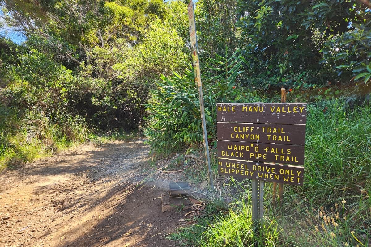
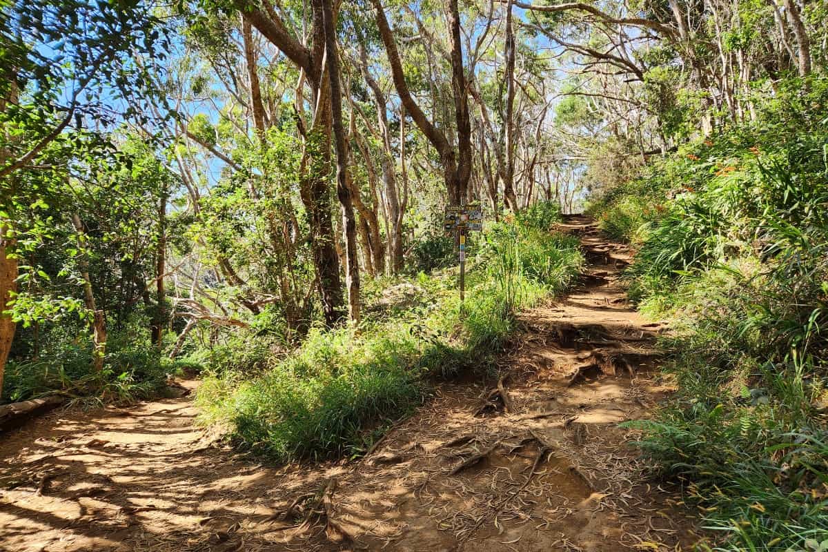
As you begin the popular hike, there are plenty of signs stating which way to go, but the Waipo’o Falls trail is easy to follow. On the dirt road, you’ll see a left that’s a dead end, so continue on your right. You end up at the circle parking lot quickly from that sign, and the marked trailhead is straight from the road.
At a short distance, you can see the sign for the cliff view. Take that right for a short 5 to 10 minute walk to see the beginning of the canyon, then head back this same way to continue the trail to the Waipo’o Falls.
Once you are back on the trail, very quickly you’ll come to the first of about 4 short, steep, rocky tree roots. It’s still easy to manage with hiking sticks or holding onto tree branches or roots, but when it’s wet it’s more of a challenge.
The rest of the trail is smooth and well-maintained through trees till you come to another sign. Stay right since the left is for the Black Pipe trail. Here the trees start to thin, and the canyon rim becomes visible. It looks far, but it’s actually very close.
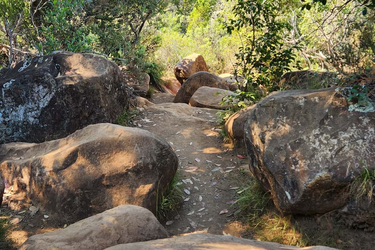
A field of dry, exposed red boulders appears, and the trail easily takes you through them, but again the dry or wet dirt can be slippery.
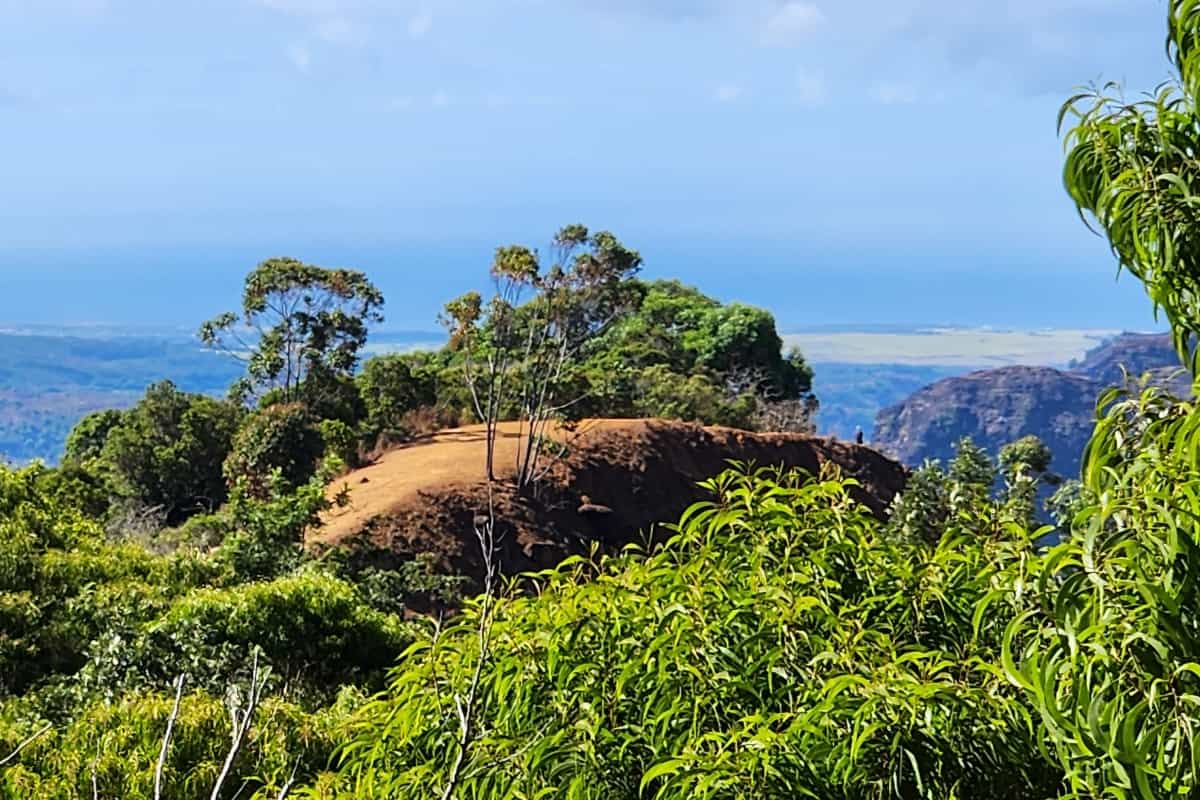
Soon you start to see the canyon and hear the tour helicopters in the air and then bam, you are on that ridge you looked at before, which first appeared far away.
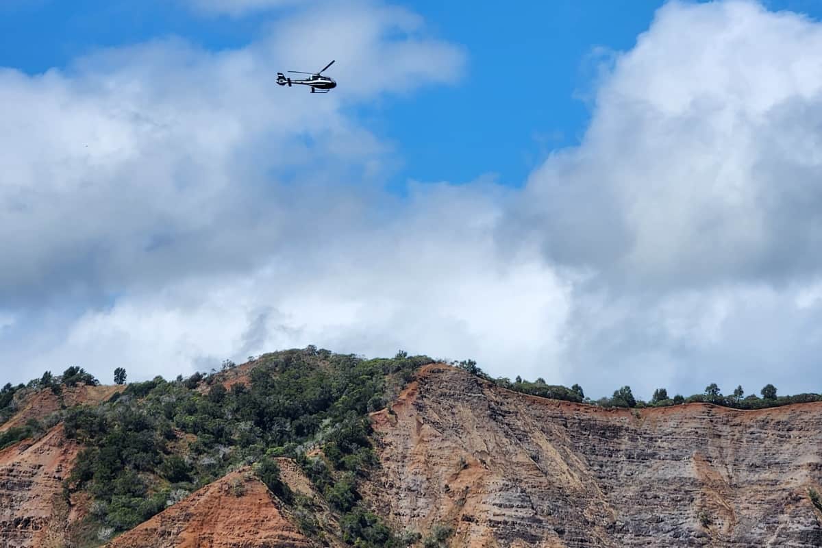
The canyon is on your right and it’s straight down with no railing, so please use caution. Straight ahead, about 200 yards, you can view the beautiful outcrops and the ocean. This is an amazing spot for photos, so stop and take some beautiful pictures.
To your left, head down to the trail on your left. In about 100 yards, you are at the small waterfall with boulders along the pool of water.
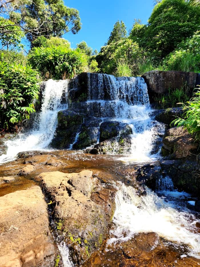
As you head back on that trail, another one splits to your left, and now you’re at the mini falls. Carefully climb down the short boulders to stand below the mini falls but above the cascading Waipo’o Falls you saw from the highway lookout.
Head back up to the ridge for a last view and enjoy the song of the Shama Thrush or watch the red-crested or brown Cardinals. They hang here since so many hikers eat their snacks on a very unusual rock near a cluster of trees and bushes.
The hike back to your car is the same way. This time it’s uphill but gradual and I actually ended up drinking more water here than the hike to the falls, so make sure to bring plenty. If you didn’t stop for lunch and need a public restroom, stop at the picnic area on your right as I mentioned earlier.
You can go back down to Waimea Canyon the same way you drove up or at the 562 junction. Take a right since it’s a different view going down and end up in Kekaha. It’s Kauai’s long stretch of beach with a parking lot to use or parking spots along the highway.
There is nothing better than exploring or seeing one more area Kauai has to offer after a hike and before heading back to your hotel.

Written by: Debra Bowyer
Leave a comment