
If you’ve ever been to Hanalei and wondered what it was like to be in the mountains overlooking Hanalei, then this is the trail for you. The Okolehao Trail takes hikers into a verdant jungle and mountain wonderland overlooking Hanalei Bay and beyond.
Though often not high on the list of Kauai hikes, the Okolehao is one of our favorites. The trail satisfies all of our cravings for an exotic adventure into a mountainous and jungle environment.
Okolehao Trail Details
Why you should do it: Jungle/mountain hike with incredible views of Hanalei Bay and beyond.
Area: North Shore (Hanalei)
Trail Length: 2.5 miles (one way)
Difficulty: Intermediate (strenuous climb) to Difficult (last 1/2 mile)
Equipment to bring:
- Camera
- Water
- Snacks
- Rain gear
- Appropriate footwear
Okolehao Trailhead
The trail begins at the foot of Hanalei’s taro fields. Going, it is almost all uphill. If it’s dry you will have a much less-challenging time than if it’s muddy. Either way, you will be winded to some degree as you make the steady climb.
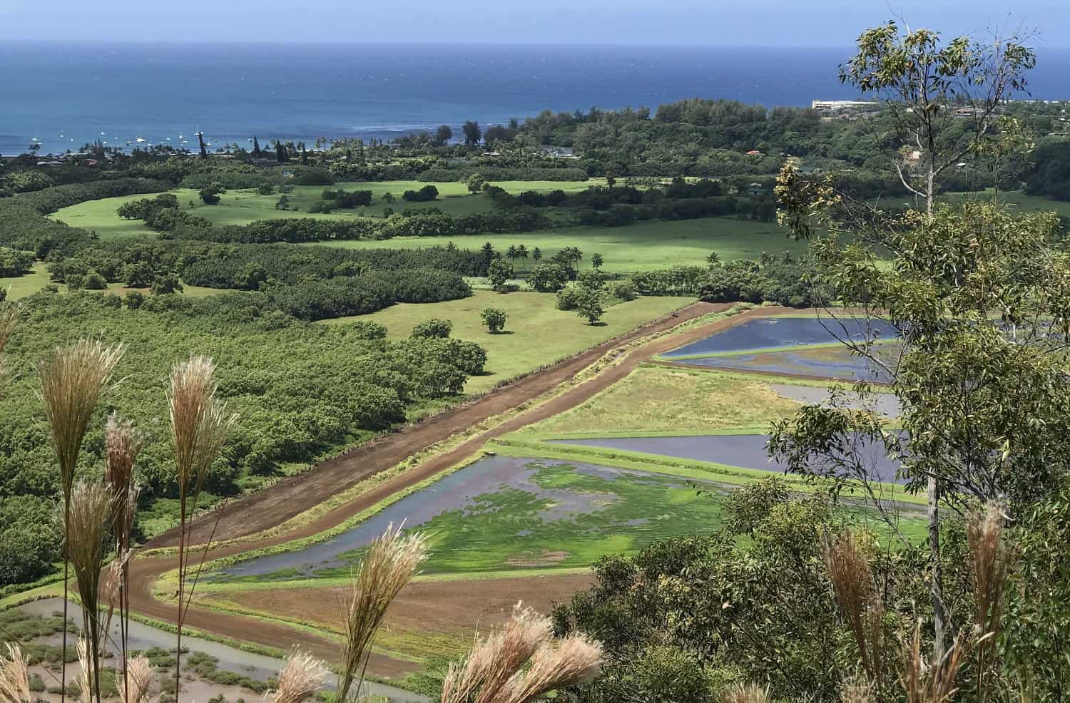
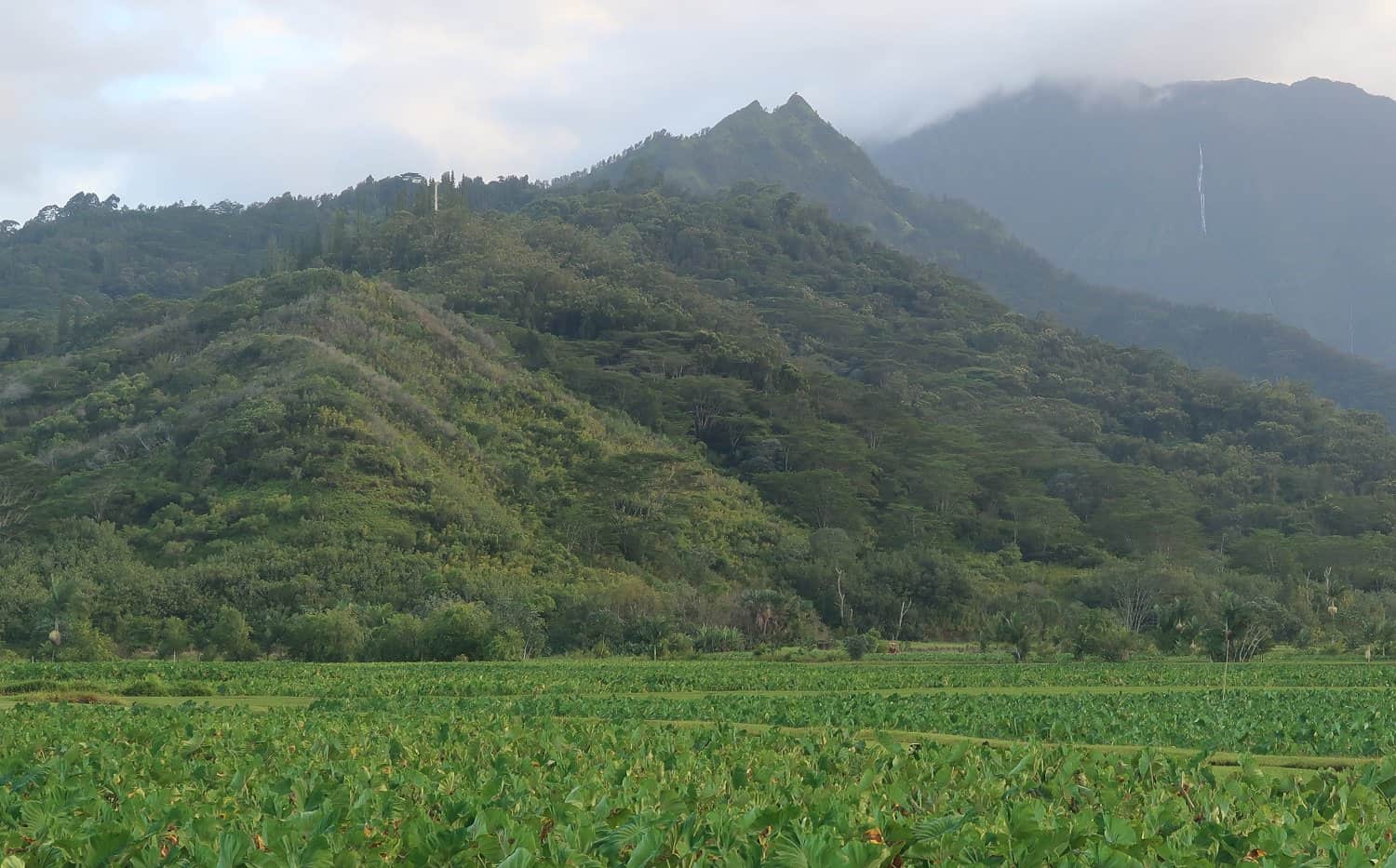
There are two main vistas along the trail. The first, about a mile into the hike, offers scenic views of Hanalei’s taro fields and the Hanalei area. The second vista, about two miles into the hike, affords sweeping views of the entire Hanalei Valley and beyond. On a clear day you can see all the way to the Kilauea Lighthouse.
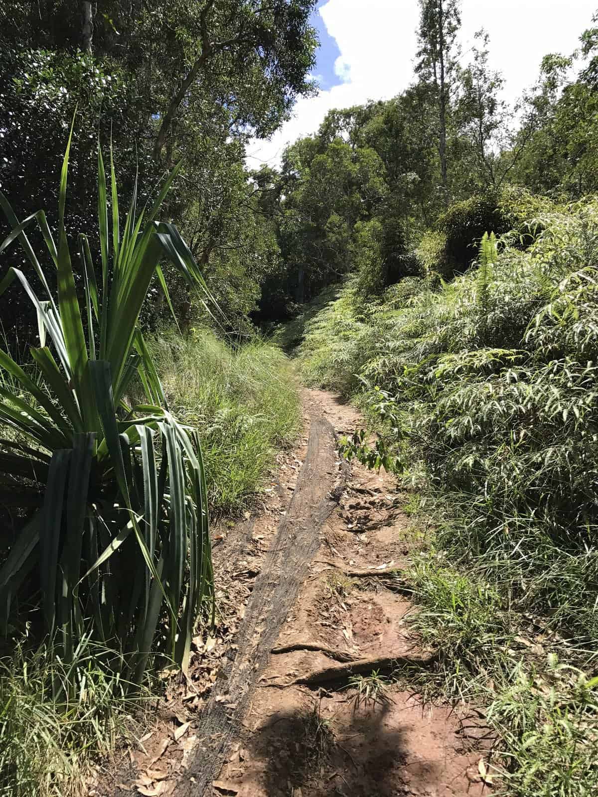
After the second vista, the trail becomes more overgrown and challenging. Only expert hikers should tackle this portion.
One thing that stands out about this trail is the wonderful flora. You can hike through a mountain jungle paradise brimming with flora in these mountains above Hanalei. Walk under Cook Pine, Eucalyptus, and Koa trees, to name a few, amidst a variety of ferns, mosses, flowers, and wild grasses.
Okolehao Trail Hike

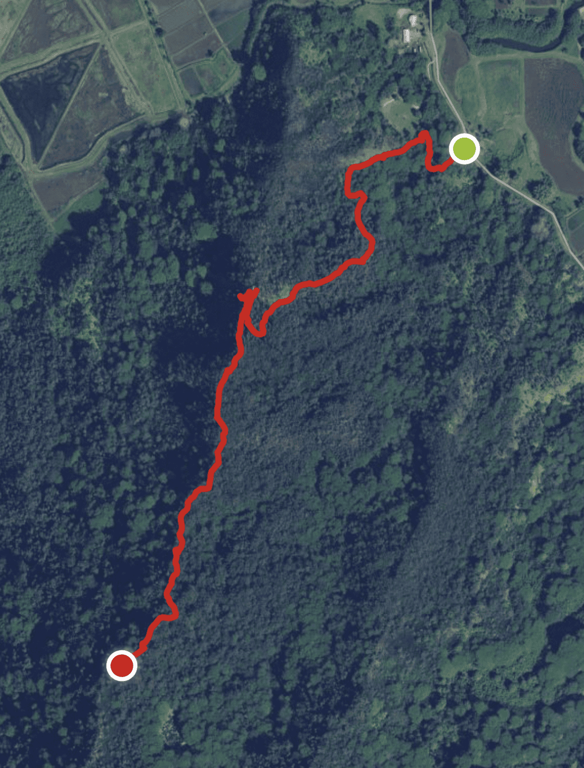
The trail begins on a small footbridge on Ohiki Road near Hanalei’s famed taro fields. There is parking for about ten vehicles across from the trail head.
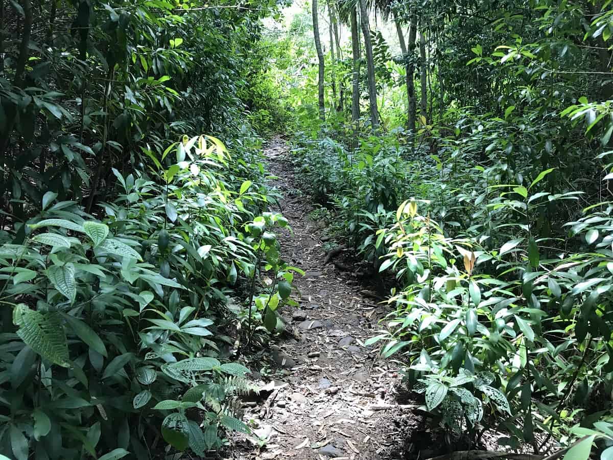
The very first part of the trail is relatively flat but it soon begins a steady incline. Part of the trail is covered by a mesh which limits erosion and provides traction.
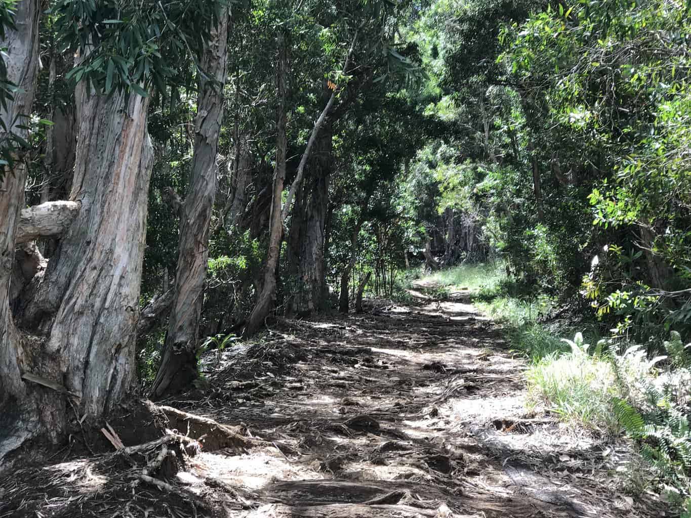
The trail is relatively wide with plenty of shade along the way. A variety of plant life can be found on the trail.

The first scenic viewpoint is near power lines. Virtually the entire Hanalei Valley is within view, including the town, beach, river, and taro fields.

Above and below: The second scenic point, about two miles in, offers even better vistas of the Hanalei area.

Above: The Hanalei River, Hanalei Pier and Hanalei Bay as seen from the second viewpoint.

Above: On clear days the Kilauea Lighthouse can be seen in the distance from the Okolehao Trail.

Here you can find hikers taking a well-deserved break at the second scenic viewpoint. There is another bench behind this one for “theater” seating!

After the second viewpoint, the trail becomes more overgrown and less traveled. There are several steep portions of the trail before you reach the end and there are additional incredible vistas to behold. Only experienced hikers should take on this section of the trail.
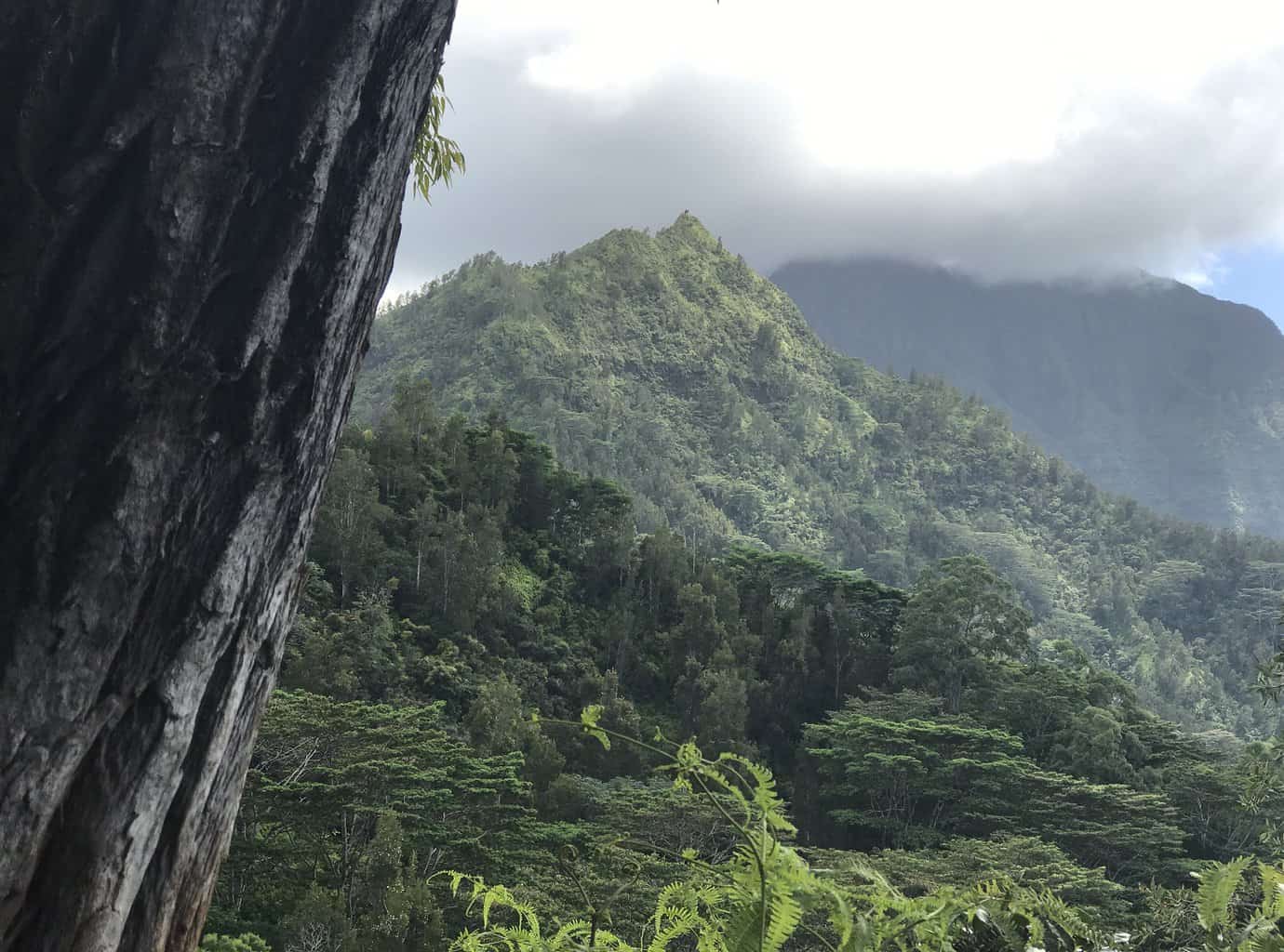
In addition to views of Hanalei Bay, the interior of Kauai can be seen from the upper portions of the Okolehao Trail.
Here is a view of the trail area seen from below. The power line tower (white) from the first overlook can clearly be seen.
Okolehao Trail Map
The trailhead of the Okolehao Trail starts on Ohiki Road in the Hanalei National Wildlife Refuge. Ohiki Road is the narrow road that starts at the Hanalei Bridge and runs parallel to the Hanalei taro fields.
Okolehao trail
We tried the trail today 06/19/2023 and did not finish it. Too Muddy and overgrown. We came to the point where we could take a left path or right path. No markers so I walked to the right and extremely muddy (nit prepared) and the walked to the left and overgrown. Decided to return to the car and tried the old Club Med trailhead in
Princeville, which was a nice short hike towards a small beach.